Shiredom 1548 Share Posted May 8, 2022 Spoiler I used nothing but Krita, a drawing Tablet, my hands, and three ******* days of my time to work on this, so help me god. Political Map of Almaris 75 S.A Too long has a map been made of the entirety of Almaris focusing on a political scale. The last ones were made decades ago in some cases. I am Peralien Maelstorm, mostly known as a terrorist against Vortice and Oren, but I also work with Cartography as a hobby. I would like to say that I am not being held against my will to write this or the creation of the map. I got on a tiny sloop and mapped the coast of Almaris, and with other knowledge of inland lakes, I mapped Almaris again. With a focus on politics and borders, not geography. (May need to open in another tab to view in higher quality, looks blurry as it is currently.) There have been many changes over Almaris over the decades since we landed. Sutica turned into Savoy. Haelun'or lost their mainland holdings. Druids gotten smaller. Fenn rose. Oren went from a Empire to a Kingdom. Supporters of the Holy Orenian Empire fled to Balian recently. The Tribes in the South turned into a Sultanate. Celia'nor was created from people fleeing from the Silver-State. Elysium split off from Norland and went to the South. Vortice has gotten smaller, lost holdings over the rough jungle. Yong Ping formed their own. Krugmar Diplomatic Expansion. May my work do some effort to undo or heal the thing's I've done against Almaris. Signed, Spoiler 10 Link to post Share on other sites More sharing options...
satinkira 5800 Share Posted May 8, 2022 Marellon steals one for his own usage. Thank you, P.. Peralien Maevisal Maelstrom Aurelius..? I shall use it well. Link to post Share on other sites More sharing options...
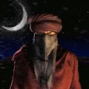
Reckless Banzai Screamer 11532 Share Posted May 8, 2022 A Du Locian volunteer smokes a cigar at a cannon battery. Surrounded by the Grand Kingdom now, it was only a matter of time before they were invaded by the dwarven problem. 9 Link to post Share on other sites More sharing options...
SteppeNomad 1552 Share Posted May 8, 2022 May that blessed league, the truly enlightened people; The Great Horde overtake all! 1 Link to post Share on other sites More sharing options...
Laeonathan 3930 Share Posted May 8, 2022 "This map is quite outdated..." a Farfolk notes, viewing it "The Sultanate of Kharasi is no more. It's been gone for almost a decade. And Balian is in the far south, isn't it? At least I saw it, there. As far as I am concerned, Balian is where the Kharasi is painted. The Kharasi was actually more western!" he stays silent for a while, before speaking again "It's pretty though" 4 Link to post Share on other sites More sharing options...
JoshBright 2104 Share Posted May 8, 2022 Spoiler Balian is in the south and east of the sultanate, tile 111 3 Link to post Share on other sites More sharing options...
Lojo613 1420 Share Posted May 8, 2022 How da zkah people nub gruk dat da goi am landlocked. It am a zkahin lake, it nub connect to da zkahin ocean. 4 Link to post Share on other sites More sharing options...
Tulan 443 Share Posted May 8, 2022 (edited) "Where are the Dual Principalities of Fenn and Nor'asath? This map is lacking." Ruathar Indoren shook his head "Better luck next time, Peralien." Edited May 8, 2022 by Tulan 1 Link to post Share on other sites More sharing options...


Recommended Posts